|
|
  |
|
| Call Number: |
D2.4.1 |
| Identifier: |
AL3288_D2.4.1 |
| Title: |
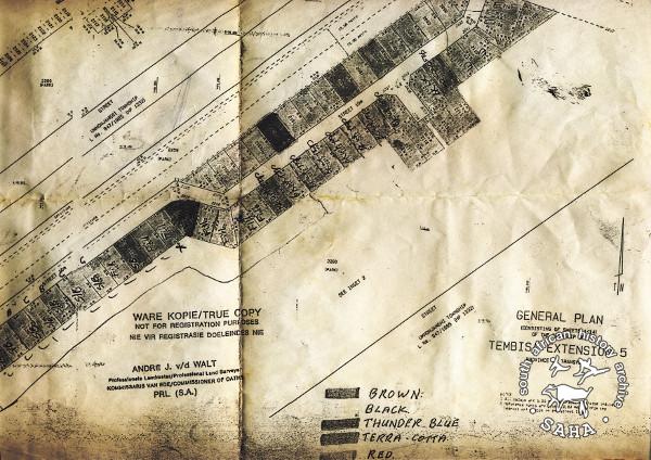
Map of Tembisa: General Plan - Tembisa Extention 5 |
| Subject: |
Andre J. van der Walt;
Map;
Survey;
Tembisa |
| Description: |
This map of Tembisa showing a general plan of Tembisa Extension 5 was collected by learners of Ingqayizivele High School from one of the interviewees and scanned by one of the project interns. Date of map is unknown.
Included in SAHA report and virtual exhibition: 'Entering Tembisa - an oral and photographic exploration of the community'. |
| Creator: |
Andre J. van der Walt, Professional Land Surveyor |
| Type: |
Map |
| Format: |
Access image - jpg
Preservation image - tiff |
| Source: |
SAHA collection AL3288 |
| Language: |
English and Afrikaans |
| Coverage: |
Tembisa |
| Rights: |
Andre J. van der Walt |
|
View Full Size Image |
Please share your views or anecdotes, particularly if you were present or affected by the events described in this poster, photograph or document.